The multidisciplinary research group Forensic Architecture, based in Goldsmiths, University of London, employs architectural methods coupled with media techniques and technologies to investigate cases of state violence and violations of human rights around the world. The group’s process and practice of incorporating emergent technological tools into creative research methods to address human rights violations provide a unique perspective on how creative technology can have a meaningful impact on society.
Following the abduction of Lt. Hadar Goldin, during the 2014 attack on Gaza, the Israeli military enacted the Hannibal Directive. In an attempt to destroy the tunnels under the city into which the Israeli soldier was taken by Hamas fighters, the directive resulted in four days of bombardment of Rafah, the southernmost city in the Gaza Strip, and the destruction of two thousand homes.
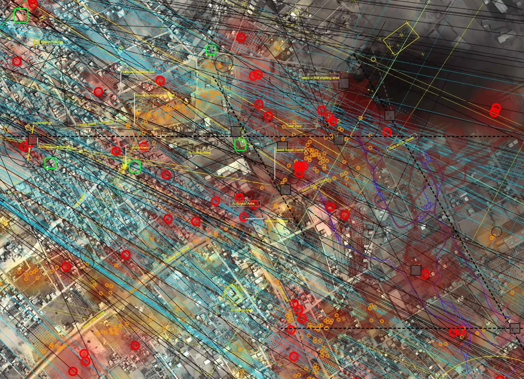
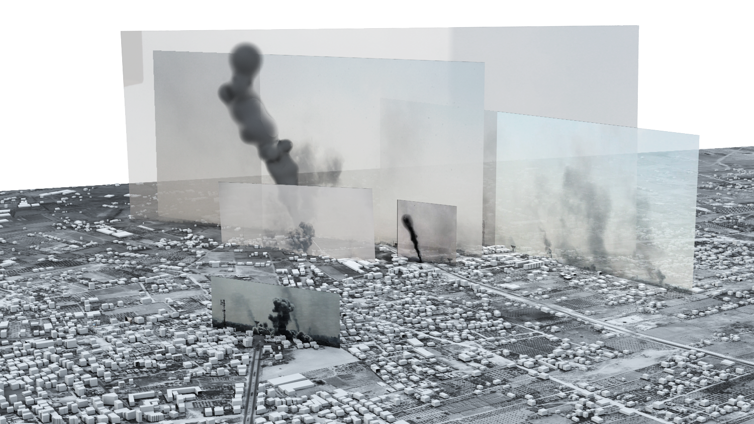
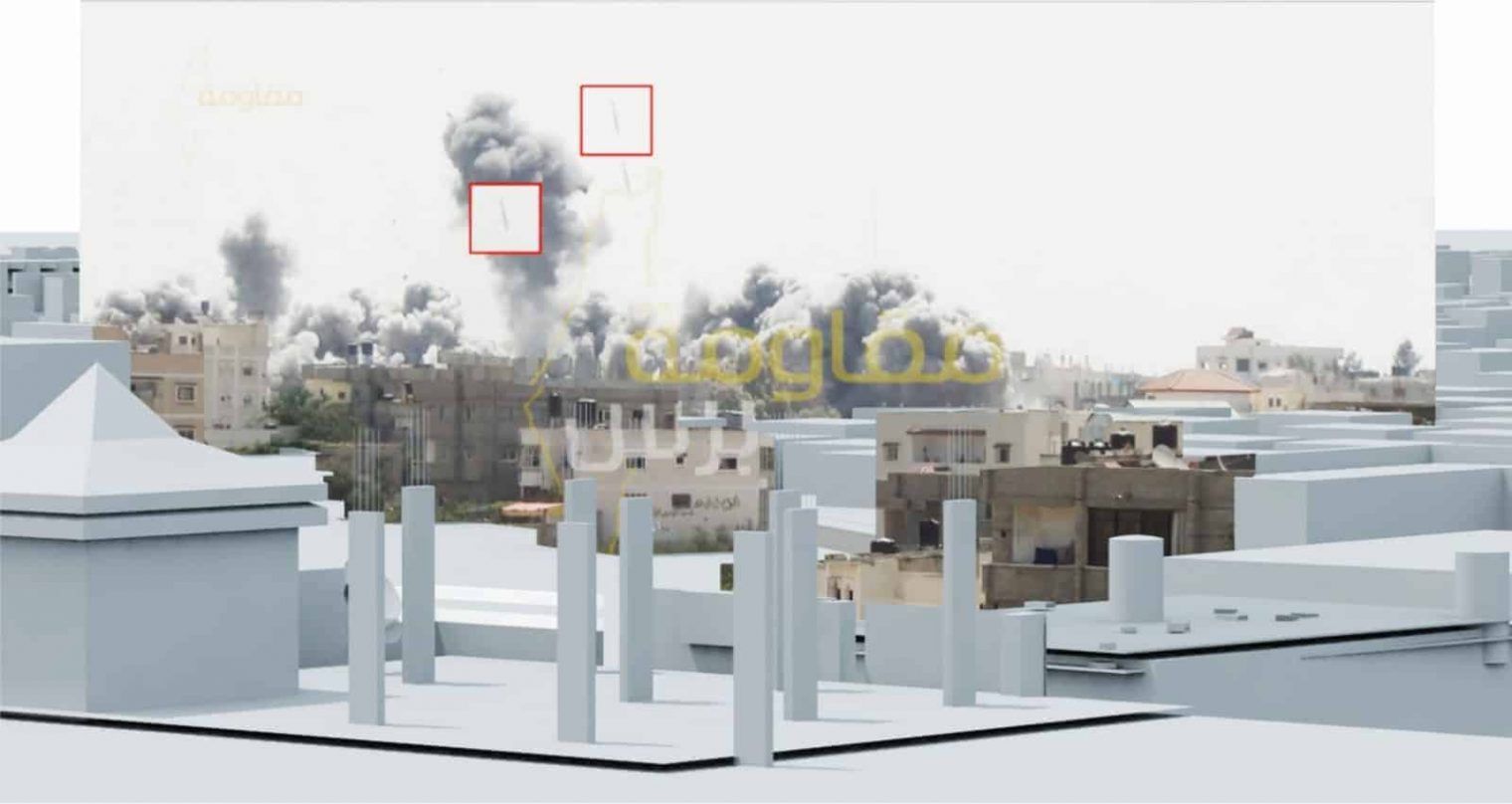
After Forensic Architecture (alongside Amnesty International) was denied access to the Gaza strip they initiated their investigation by collecting thousands of images and videos posted on social media sites by the residents of Rafah as well as images and videos sent directly from journalists. Forensic Architecture then began a process of reconstructing the time and space of the bombings through a detailed analysis of the images, studying visual traces of shadows and the shape of bomb clouds. This process was necessary as social media can strip imagers of their temporal and spatial metadata.
This analysis was used to create a digital model incorporating the acquired ground-level images and video with satellite imagery. The temporal and spatial mapping led to substantive findings, included in the “Black Friday Carnage in Rafah” report produced by Amnesty International. Through the 3D model, the use of US-manufactured MK-84 / GBU-31 JDAM one-ton bombs was identified, and the Amnesty report found the use of this munition as a war crime.


